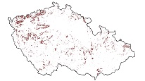
Abandoned mine lands
This ArcGIS Server Service displays key information on areas where underground mining or mineral exploration was undertaken in the past. It provides warnings about areas where subsidence or other hazards may occur due to the presence of underground spaces.

služba
https://registry.geology.cz/id/VDC-PODDOL-SDE-SER
ESRI_MAP
1.3.0
ISO 19119:
GEMET - INSPIRE themes, version 1.0:
CGS Geoscientific themes:
11.6856652922758,
48.1873553053326,
19.0509812926251,
51.4960571840313
vytvoření: 2002
Ing. Martin Paleček
Leitnerova 204/22,
Brno,
602 00,
Česká republika
tel: +420543429261
email:
martin.palecek@geology.cz
Role: kontaktní bod
Klárov 131/3,
Praha 1,
118 00,
Česká republika
tel: +420257089411
email:
metadata@geology.cz
Role: správce
Kvalita
Omezení
Informace o metadatovém záznamu
561e1c0e-8b30-4dbb-b8e1-11000a010852
Mgr. Pavla Kramolišová
Kostelní 364/26,
Praha 7,
170 00,
Česká republika
tel: +420 234 742 161
email:
pavla.kramolisova@geology.cz
Role: kontaktní bod
24.04.2025


