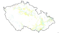
Quaternary map 1 : 500,000 (GEOCR500)


ArcGIS Server Service shows the distribution of Quaternary aeolian, fluvial, glacial and organic sediments and volcanites, whereas the colluvial sediments are omitted. Fluvial gravel forms typical staircases. Recent floodplains are separately represented because of possible flooding during the high water stands. The glacial sediments appear marginally in northern Czechia and northern Moravia. The peats occur in the mountains, whereas fens are related to lower altitudes. Two types of travertines represent Quaternary carbonates. The first one are carbonates of thermal mineral water, the second precipitated from cold ground water.
služba
https://registry.geology.cz/id/NGMD-GEOCR500_KVA-SDE-SER
ESRI_MAP
ISO 19119:
CGS Geoscientific themes:
GEMET - INSPIRE themes, version 1.0:

11.9391596825,
48.2338253671,
18.9576171015,
51.3548947086
vytvoření: 01.02.2012
Ing. Martin Paleček
Leitnerova 204/22,
Brno,
602 00,
Česká republika
tel: +420543429261
email:
martin.palecek@geology.cz
Role: kontaktní bod
Klárov 131/3,
Praha 1,
118 00,
Česká republika
tel: +420257089411
email:
metadata@geology.cz
Role: správce
Kvalita
Omezení
Informace o metadatovém záznamu
5addd653-282c-41f6-af54-411d0a010852
Mgr. Pavla Kramolišová
Kostelní 364/26,
Praha 7,
170 00,
Česká republika
tel: +420 234 742 161
email:
pavla.kramolisova@geology.cz
Role: kontaktní bod
27.02.2026