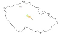
Hydrogeological map 1 : 50,000 – regions
The ArcGIS Server map service displays hydrogeological maps that were processed during the solution of various types of projects in the CGS. The extent of hydrogeological units is derived from the geological map on a scale of 1: 50,000 and the HydroGEOČR50 layer, which was created within the R&D project of the Ministry of the Environment of the Czech Republic SP/2e1/153/07. Within the individual regions, the values of the transmissivity of the hydrogeological units, the type of the hydrogeological environment and the sequence of collectors and aquicludes in the Czech Cretaceous basin are shown in the hydrogeological maps.

služba
https://registry.geology.cz/id/NGMD-HYDROCR50_REG-SDE-SER
ESRI_MAP
13.886,
50.478,
14.318,
50.59
vytvoření: 31.05.2020, zveřejnění: 17.07.2020
Ing. Martin Paleček
Leitnerova 204/22,
Brno,
602 00,
Česká republika
tel: +420543429261
email:
martin.palecek@geology.cz
Role: kontaktní bod
Klárov 131/3,
Praha 1,
118 00,
Česká republika
tel: +420257089411
email:
metadata@geology.cz
Role: správce
Kvalita
Omezení
Informace o metadatovém záznamu
5ed638e2-f96c-4ff3-9494-2e760a010852
Mgr. Olga Moravcová, Ph.D.
Klárov 131/3,
Praha 1,
118 00,
Česká republika
tel: +420257089445
email:
olga.moravcova@geology.cz
Role: kontaktní bod
24.04.2025

